

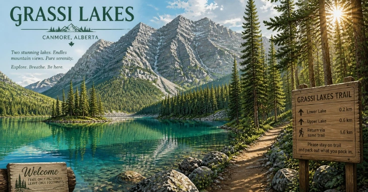
The Grassi Lakes hike near Canmore is known for clear turquoise water, mountain views, and two routes that suit different ability levels. There is one crucial detail for anyone planning a 2026 visit: the area is currently closed because of rockfall hazards. Our related guide, Joffre Lakes Provincial Park, goes further into this.
Short answer: The trail system is closed until further notice following a June 2026 rockslide. Alberta Parks closed the Upper and Interpretive routes, the day-use area, and nearby access while safety work continues. Check the official park status before leaving. Canmore, even if an older map or hiking guide says the trails are open.
| Key detail | What to know |
| Location | Canmore Nordic Centre Provincial Park area, Alberta |
| Current status | Closed until further notice |
| Reason | 2026 rockslide and continuing rockfall risk |
| Normal hike length | About 4 km |
| Normal hiking time | Roughly 1–2 hours |
| Typical elevation gain | About 170 m for the common outing |
| Main routes | Upper Trail and Interpretive Trail |
| Difficulty | Easy route or more challenging intermediate route |
| Vehicle pass | Kananaskis Conservation Pass normally applies. |
| Dogs | Keep pets leashed. |
| Winter | The interpretive route normally closes due to ice. |
Travel Alberta and Tourism Canmore Kananaskis describe the usual outing as roughly four kilometers with about 170 meters of elevation gain. Most visitors allow one to two hours.
Is Grassi Lakes Open in 2026?

No, not at the time of this update. A rockslide in June 2026 led Alberta Parks to close the day-use area, Upper Trail, Interpretive Trail, Reclaimer Trail, and affected road access. Recent local tourism information still labels the attraction as closed until further notice.
That wording matters. There is no dependable reopening date to build a trip around yet. Avoid entering the closure even when a route appears physically passable. Officials have warned about unstable rock above the road and trails. Rock removal and slope stabilization work can also increase short-term hazards around a work zone.
For other trip-planning ideas while conditions change, browse LifeVoria’s broader travel coverage and discover additional destinations and outdoor experiences beyond Grassi Lakes.
Where Are the Lakes?
The trailhead sits just west of Canmore in Alberta’s Canadian Rockies, near the Canmore Nordic Centre and Spray Lakes Road corridor. Tourism Canmore Kananaskis lists the usual trail access at Ken Ritchie Way in Canmore. The lakes sit above the Bow Valley within the provincial park system.
Their location makes the hike attractive to travelers staying in Canmore. Under normal conditions, you can fit the outing into a morning or afternoon rather than committing to a full-day mountain hike.
The two shallow aquamarine lakes are named for Lawrence Grassi, a local trail builder and climber. Alberta Parks notes that interpretive signs along the more difficult route explain his history. If Canmore is part of a longer urban-and-mountain trip, LifeVoria’s destination section can help you organize other stops.
Which Trail Would You Take After Reopening?
The hike normally gives visitors a choice shortly after leaving the trailhead.
| Route | Terrain | Best suited to | Main attraction |
| Upper Trail | Wider, gentler old road | Families and hikers wanting the easier climb | Steady route to the lakes |
| Interpretive Trail | Forest path with steeper sections and stairs | Hikers comfortable with a moderate climb | Waterfall and Bow Valley views |
The Upper Trail follows a gentler grade through forest. It is the simpler option when your priority is reaching the water with less demanding terrain. The Interpretive Trail is more interesting for many confident hikers. It climbs through forest before reaching a steep section with waterfall views and a wider look across Canmore and the Bow Valley.
Alberta Parks rates this route intermediate. A common plan after reopening would be to use the more scenic path in one direction and the easier route in the other, subject to current trail rules and conditions.
How Difficult Is the Hike?
Under normal conditions, this is a short mountain outing rather than a major backcountry trek. Tourism sources describe a roughly four-kilometer trip that usually takes one to two hours. The easier path climbs steadily, while the interpretive option adds steep stairs and rougher terrain.
That makes route selection more important than the distance alone. Families with younger children may prefer the gentler path. Visitors with solid footwear and reasonable fitness may enjoy the waterfall route more. Neither option should be treated as risk-free mountain walking. Weather changes fast near Canmore, wildlife uses the area, and icy sections can appear outside summer.
Parking, Transit, and the Kananaskis Pass
When the trail is operating normally, summer parking can become busy. The Town of Canmore advises visitors to start early and avoid parking on road shoulders when designated lots are full. It also lists seasonal Route 12 transit service between downtown, Quarry Lake, the Nordic Centre, and the hiking area from May through October.
Current closures can affect both road and trailhead access, so don’t assume those normal arrangements apply until the area reopens. A Kananaskis Conservation Pass is normally required for private vehicles parked within applicable Kananaskis and Bow Valley areas. The provincial order lists a $15 daily private-vehicle pass and a $90 annual pass. Confirm current fees before travelling.
Canadian holiday weekends can also change traffic and attraction demand. LifeVoria’s Canadian long-weekend planning article explains why checking attraction and transport schedules before departure matters. Canadian long-weekend travel planning
What Should You Bring When the Area Reopens?
A short hike still deserves basic mountain preparation. Bring supportive footwear, drinking water, weather-appropriate layers, sun protection, and a charged phone. Alberta Parks also recommends accessible bear spray when hiking in areas where bears may be present.
Keep dogs leashed. Stay on designated paths rather than creating shortcuts around muddy or crowded sections. Alberta Parks asks visitors to remain on established trails and give wildlife space.
In colder months, traction can matter. Tourism Canmore Kananaskis advises using microspikes on the easier trail when winter ice forms. The Interpretive Trail normally closes during winter because flowing water can create hazardous icy sections.
When Is the Best Time to Visit?
Once access resumes, late spring through early autumn usually provides the widest range of hiking options. Summer brings warmer conditions but also heavier visitor numbers. An early start can make parking and trail traffic easier to manage.
Autumn can bring cooler temperatures and changing conditions. Winter traditionally limits visitors to the easier route, with traction aids often needed. For 2026, though, season matters less than closure status. A sunny forecast does not make a closed slope safe. Check
Alberta Parks and current local tourism information on the morning of your trip. If the closure remains, choose another open trail in Canmore or Kananaskis rather than attempting to bypass barriers.
Plan Around the Official Trail Status
This remains an appealing short hike for a future trip to Canmore. The combination of turquoise water, forest, waterfall views, and two route choices explains its popularity.
For now, the right plan is simple: do not travel to the trailhead until the closure is lifted. Check Alberta Parks before departure, confirm road access, and then review parking, transit, weather, wildlife notices, and pass requirements. Once officials reopen the area, those few checks will help you enjoy the hike without relying on outdated directions or pre-rockslide trail information.
Conclusion
Grassi Lakes near Canmore remains one of Alberta’s most memorable short mountain hikes, thanks to its striking turquoise lakes, forest scenery, waterfall views, and spectacular views across the Bow Valley. Under normal conditions, the trail offers a rewarding outing for a wide range of hikers, with the easier Upper Trail and the more challenging Interpretive Trail giving visitors some flexibility in how they experience the area.
However, the most important thing to remember in 2026 is that the usual hiking experience is currently unavailable. Following the June 2026 rockslide and continuing concerns about rockfall and slope stability, the area remains closed until further notice
Frequently Asked Questions
No. As of this August 2026 update, local tourism information continues to list the area as closed until further notice following the June rockslide. Always check Alberta Parks before travelling because the status can change.
Plan on roughly one to two hours for the usual four-kilometer outing. Add time if you want a relaxed stop by the water or frequent photo breaks.
The easier Upper Trail is normally suitable for many beginners and families. The interpretive route is steeper and includes stairs, rougher ground, and a more demanding final section.
Drivers parking within the applicable Kananaskis Conservation Pass area normally need a vehicle pass. Check Alberta’s current pass requirements and fees before departure.
Dogs are permitted in Alberta provincial parks under normal rules, but they must remain leashed. Wildlife activity can lead to extra advisories or restrictions.